Our clients undertake many different types of archaeological work, from large strip, map and sample projects (e.g. in preparation for large industrial units or housing schemes) to small evaluations or watching briefs (e.g. private house extensions or the development of garden plots). Below are some examples of our recent projects:

Bax Farm, Sittingbourne, Kent - aerial photo and digitised plan: A digitised plan of this Roman Bath house was produced for a Kent based archaeological contractor undertaking a research excavation.


Neatscourt, Sheppey photo and High definition scan data: A Prehistoric burial mound was discovered underneath 1.5m of alluvial deposits. It was fully excavated, hand planned in the field and then digitised using CAD. A 3D laser scan was taken mid-excavation to provide a 'real world' visualisation and archaeological record (in this image, false colour has been used to provide a sense of depth).


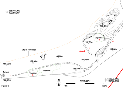
Friston-Folkington water pipeline, East Sussex: This is a topographic survey which employed the extensive use of the GPS and Total station to accurately map the archaeological features seen in the landscape.
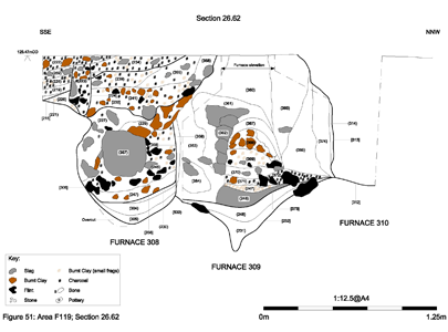
As well as plans, we can create sections using CAD by digitising the hand drawn archaeological drawings made in the field. These are often simple (see ditch sections below) but may be much more complex as shown below in a section of three Iron Age furnaces found near Stockbury, Kent.
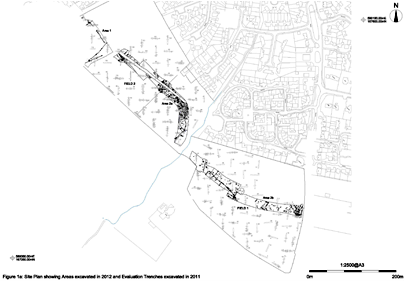
Neatscourt enclosure - strip, map and sample: Site plan created by combining all the digitised hand drawn plans, the georeferenced location of which had been surveyed using the GPS onsite.
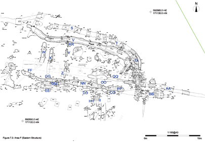
Bapchild Phased Plan: This phased plan uses colour to graphically represent the archaeological periods to which features have been assigned, based on pottery analysis.
